Running for the pies

Running for the pies
Showing posts with label Trail Ultra. Show all posts

Saturday, 3 April 2021

27th March: Getting triggy with it.


The end of lockdown is nigh and its dusk is now beginning to settle with hopefully a full diary of races looming just over the horizon ready to be lit by the rays of a new dawn. As rose tinted as this view may be, its sadly still just in the realms of wishful thinking rather than reality. The last year bar a couple of merciful exceptions for me in October and early December saw races replaced by virtual facsimiles of the real thing and the  ingenuity of personal challenges.

Rather than letting my stamina slip I’ve been meandering around cracking-out the miles locally, however mundanity has been taking over and I’ve found myself just going round and round the same places time after time almost going through the motions over the various routes you can run back and forth.

On these many galavants around my local area, several times I’d passed 4 different trig points and it got me thinking… Hitting the maps I did a bit of a search to find out if there were any more nearby to be ‘bagged’ on a run. It turned out there were 7 accessible trig points to my village and even better it was essentially possible to run a circuit between them all!

Ok at the risk of losing most of you already, I realise those who are uninitiated to the delights of ‘trig points’, or the practice of trig bagging’, are wondering what in the yellow rubbery arse I am waffling on about… Well…

In Britain we had 6,500 triangulation (trig) points made of an identical concrete obelisk design built from 1935 to 1962 by the Ordnance Survey, of which it is believed around 5,500 still remain standing. Their designed purpose was to provide the Ordnance Survey with a method of making an accurate measurement of height for the topography of the whole of Britain. The process of calculation was done via triangulation (hence their name), meaning from every trig point when they were built, you should be able to view at least two others. This measurement process though was laborious as it could only be carried out via line of site using a theodolite between the points and therefore could only be undertaken in clear weather from the grand total of 30,000 selected locations required!

Nowadays, with the steady march of technology and the advent of lasers, the Ordnance Survey can perform the same function provided by these 6,500 pillars from a mere 110 points dotted over the country. As a result, accuracy from the survey ending in 1962 has improved from a margin of error of 20m from one end of Britain to the other, to a mere 3mm error today!

What we now have with these trig points is an obsolete relic of a time gone by. Redundant and functionally useless they remain lonely and largely unloved abandoned to the elements. When you say ‘trig point’, the image most people have of them is a concrete obelisk standing a lonesome sentinel on the crest of a hill visible as a spec on the horizon from miles away, their grey concrete slab sides yellowing and greening as they become encrusted in lichen, algae and moss and baring the scars of the lashings of the wind and rain of nearly a century for the oldest ones. Thing is, this view is not quite what they all are. For every trig point that is up high, you will need another down low to be able to achieve triangulation, so there’s plenty all over the country to be found in random spots at lower level.

Consulting the map and the trig bagging websites, I realised as well as these 4 I knew of, there were others out there that are accessible, as well as one that was not (it sits in fenced-off land in the middle of a private estate), so in a circle from my village a notional ring of 7 is formed.

Plotting a route between them over trails came out at 37 miles, which was certainly a ‘doable’ distance for me, so my challenge was set: run them all as a oner!

The planned route

Rather than just diving straight in, for my longer weekend runs and being able to squeeze some different routes out of the process, I went forth and recce’d the 3 points I had never visited before to ensure they were in fact accessible and how they could best be approached. Also having never run between these individual points I did so where I was unsure of the routes, so when the day came I could essentially be on auto-pilot rather than continually faffing around by looking at a map on my phone.

Once I was sure of the various turn points, access points and the route in general, it was time to choose a date. I went for the last Saturday in March. I could have chosen the Sunday, but with the clocks changing for British Summer Time at 2am on the Sunday I’d be losing an hour’s sleep and couldn’t be arsed with doing a very long run on top of that.

I had been prepared for poor weather and to go run it in the rain, however by a stroke of good fortune the meteorological gods were smiling on me and come the day it was forecast for a sunny start before clouding over and mercifully no rain.

Having controlled as many of he unknowns as possible, the most important choice for the day was my daps. I had a bit of a dilemma as my comfy pair of trainers have 900 miles on them and are approaching imminent death with virtually zero grip left on the sole and the uppers barely hanging together. My pair with decent grip on them are uncomfortable for running on hard surfaces for an extended period through having minimal cushioning, plus the uppers are through in a couple of places, so safe to say I had doubts either pair would survive a 37 miler in one go, regardless of both their pros & cons. This left me with only one alternative and that’s the pair I use for summer trails. Fortunately they are comfy but the tread on them is not brilliant so I knew they’d be sketchy as hell on the muddy parts, however they would be comfy on the harder packed trails which I knew would be the majority of the route as well as any stretches of tarmac. With the weather being largely dry through March fortunately the trails have started to dry-out and harden so I knew I’d just have to suck it up buttercup on the muddy stretches.

This adventure was to be entirely self sufficient, so to help me along the way I had my light running pack with a 2L bladder in it, food in the pouches and a first aid kit, camera & phone and most importantly: Spud snacks to fuel my companion on the adventure. I decided against taking a waterproof as the forecast was free from rain with wind not too bad and temperature good for the time of year. Instead I opted for a long sleeve merino base layer to keep me warmer and hoped the forecast would be accurate, or if not it would provide an incentive to run faster!

Packed & ready.

8am arrived and I was out the door in the glorious morning sunshine shackled to a very excited Spud the trail hound. Escaping the village northwards at around 2 miles in I happened to bump into a different running buddy in the form of Steffen who had accompanied me on my final recce the previous week and I had nearly broken in the process by pushing him a bit harder than he would have liked for pace! He was on his way back from a morning 10k at his own pace having reached the turn, and he wished us luck with our endeavour.
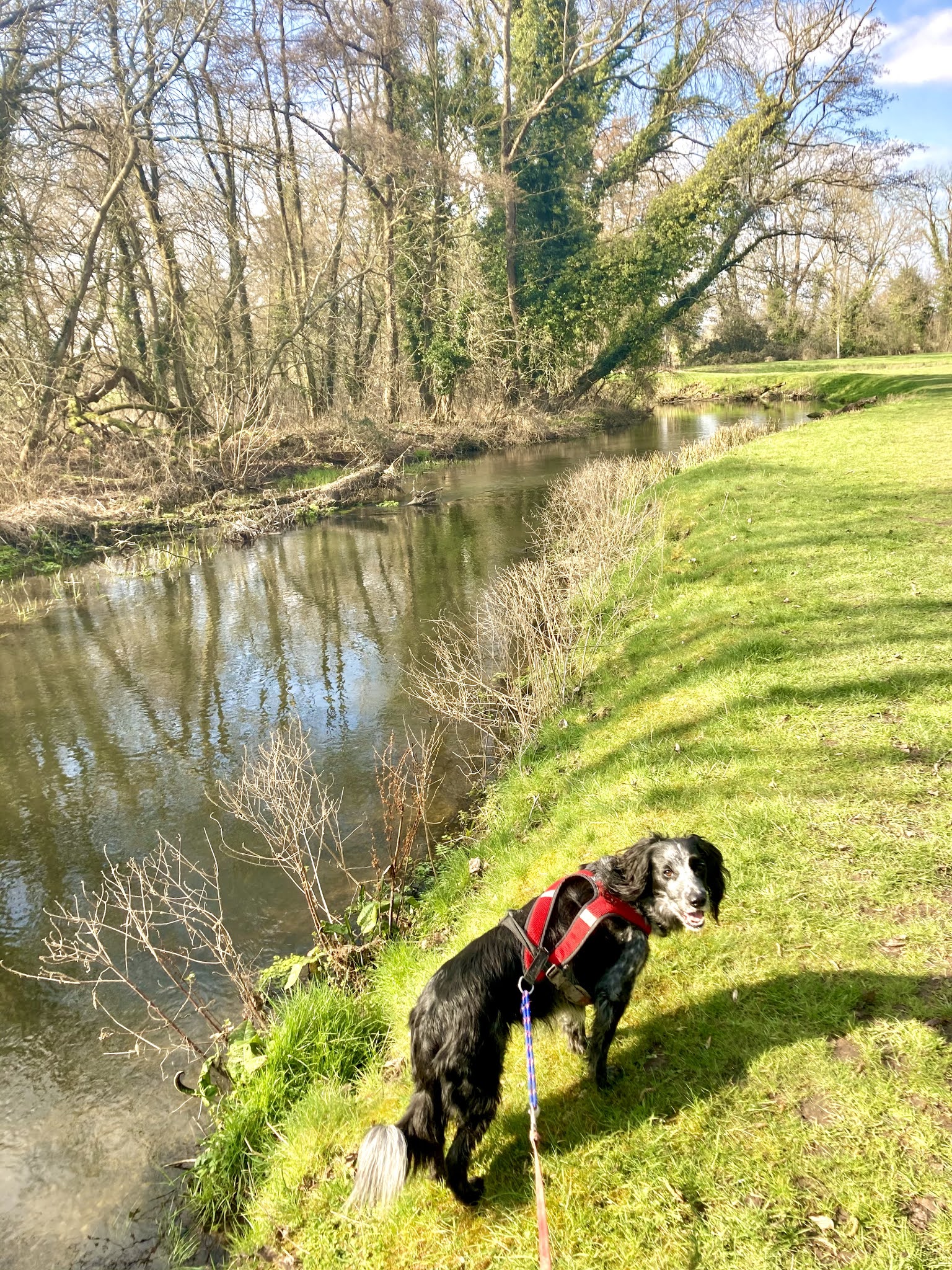
Hitting the water meadow.

Crossing the water meadows and a chalk stream we were soon at the first trig point of the day in the hamlet of Hartley Wespall. This one sits in the middle of a field with a Cold War nuclear fallout shelter/ observation post about 20 metres further into the field from it. When I got closer I could see someone had left a painted stone with a wonderful sentiment on top of it for someone to find!

The second leg was going to be the one with the most running between two points. I had to travel from Hartley Wespall to the flats at Blackbushe. Traversing a WWII tank testing ground at Hazeley Heath, a location where captured Axis tanks were evaluated and tested to destruction, then over the mix of single-track pine woodland and gravel quarry roads at Warren Heath until I eventually found myself at Blackbushe and the only mile or so of the whole run I was not looking forward to.

The church at Hartley Wespall

The second trig point was hidden in the verge on the south side of the A30. You cannot see it from the road and unfortunately there’s no footpath along the side it is on and the other side is just as bad being a narrow verge and chain link fence separating the road from Blackbushe airfield, or RAF Hartford Bridge as it was originally known.
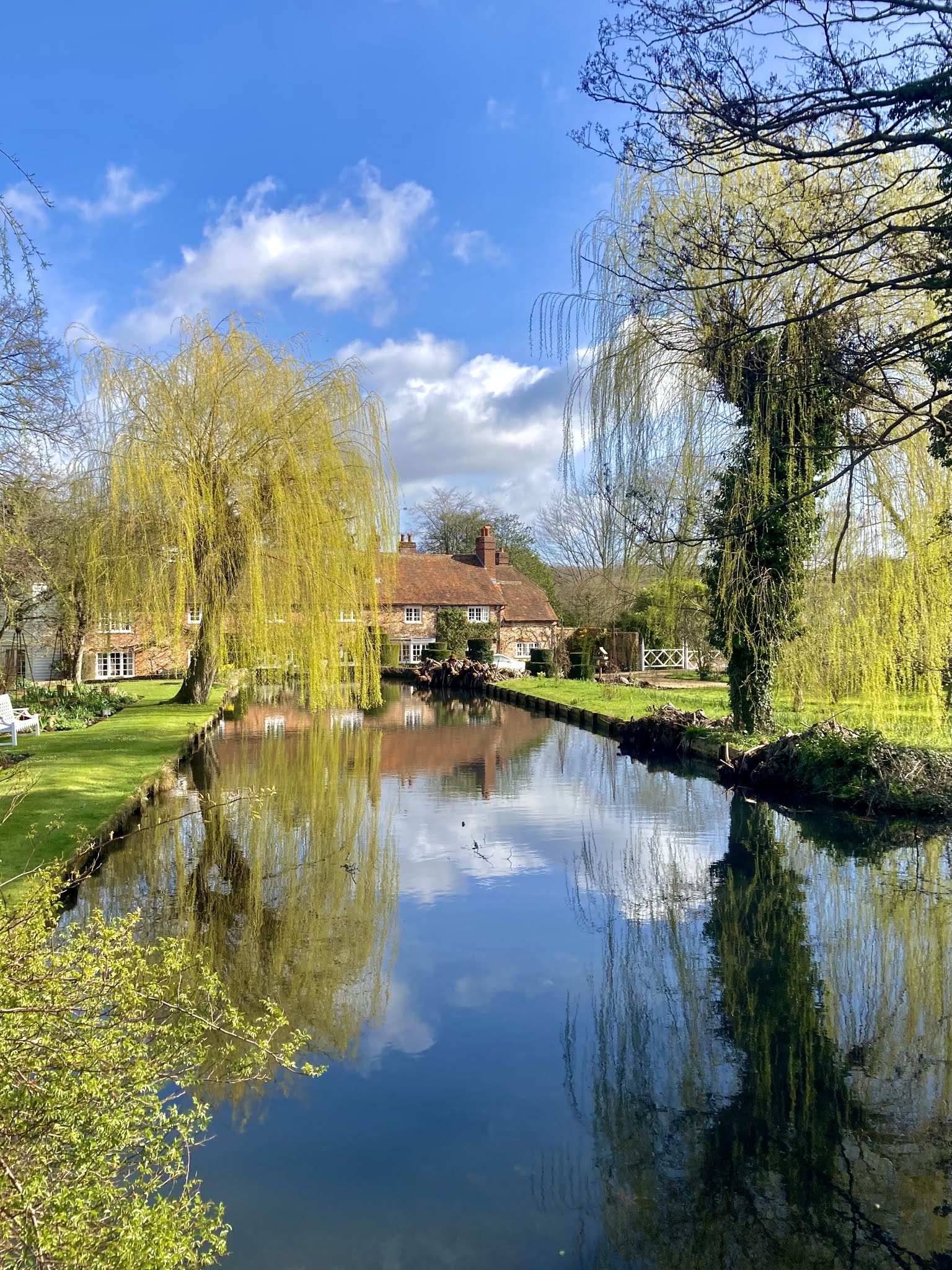
Dipley Mill

RAF Hartford Bridge was pretty unique in that it was built straddling a main national transport artery at the time, the A30 being the main route from London to the South West of England. The runway was on the north side of the road and to the south was to be found the hangars for the base. When planes needed to taxi to the runway then the A30 had to be physically closed at both ends to allow them to cross the road - you can imagine the sight of a couple of squadrons of American made Boston medium bombers snaking their way Indian-file across the road to take off on raids over mainland Europe, much to the annoyance of any drivers out and about using their petrol rations!

Surviving the alpaca-lypse on the way to Blackbushe.

Nothing remains of the old hangars and other associated buildings south of the A30 as the site is now given-over to sand and gravel extraction. The only thing of note there these days is the trig point we were visiting!

Running along an uneven grass verge with traffic approaching at 70mph isn’t fun at the best of times by yourself, let alone being roped to an idiot spanner. Spud as much as he is a fantastic running buddy has zero road-sense, so has to be kept on an extremely tight lead in such situations in case he decides to try and make friends with a passing car… As such I had to make my way along the narrow grass verge which had drainage ditches cut into it from the road every 20m or so. One hand was holding Spud’s long line almost at his harness and pulling him tightly to heel, the other hand had my phone in it as I tracked my progress in real time towards the blue triangle with a dot on it on the OS map so as not to overshoot it, as the last thing I wanted to do was to double-back on myself along this verge!

2/7 alongside the A30 at Blackbushe.

Mercifully I found it with zero bother, so taking a pic of the trig it was a case of carrying along the A30 for another mile till we could leave it and join the north westerly edge of Hawley Woods. Skirting the edge of Gibraltar Barracks, the basic training barracks for recruits into the Royal Engineers.

Hawley Woods has been continually used by the army since shorty before WWII. Now Gibraltar Barracks sits on its Westerly edge, whereas before this the now long demolished Gillemont Barracks stood on its southerly tip hosting the Canadian Infantry regiment of ‘Les Fusiliers Mont-Royal’ during the Second World War and afterwards the Paras and the Royal Engineers until it was demolished as obsolete in favour of the new Gibraltar Barracks. The woods also contains its own rough landing strip that was used by the Special Operations Executive in the war to transport agents in and out of France.

As we followed the trail parallel to the barracks’ fence, just along from the quarters I noticed out of the corner of my eye on the other side of the fence a small shape moving towards us, before it ran past and stood just below the warning sign on the fence. During the previous week we had heard the announcement on the new that there was to be wholesale military cut backs and down-sizing, but I had never thought they'd be this drastic or immediate in effect as just along from the ’Guard Dogs on Patrol’ sign was this diminutive Boston Terrier woofing at Spud!

Skirting the edge of the airfield in the woods we crossed an oft-used film location, last seen in the previous Jurassic World movie and climbed the mound to trig point #3.

3/7 in Hawley Woods.

From here it was a mile of downhill before 10k of flat running as we left Hawley Woods behind via the lake within (another film location from ‘Sahara’), crossed Minley Road in the shadow of Minley Manor (yet another film location from Stardust) that was formerly used as the officers’ quarters for Gibraltar Barracks until about 10 years ago.

Minley Manor (from on another run).

From Minley we crossed over the M3 motorway and skirted Fleet Pond, before a 100m or so stretch along the Basingstoke Canal tow-path had us scrambling up and embankment and onto more army land.

The 4th trig point is located on a hillock on the edge of the army’s high-speed off-road driving range. During the week this area is out of bounds to non military personnel because of the vehicles hooning around it at speed through the mud and puddles, however at the weekend its open to us civvies and fair game for a visit (although its always advisable to check in advance if it is)… The problem though with the area being semi-secure to stop unwanted weekday interlopers, access is only really from a few select points, none of which were anywhere near my direction of approach and my ideal route across the site. A stroke of luck for me on this foray was found on my recce with an emergency access gate located with not too far a diversion from a straight line route. This gate is always locked and designed to not be easily climbable but there’s enough of a gap to squeeze around the side of it if you’re svelte enough, or if you’re a fat bastard like me, then you can get on your back and slide under it! Back on my feet and I was soon at the trig point and overlooking the end of Farnborough’s runway, the long and storied home of British aviation and the locale of the first powered flight in Britain.

4/7 overlooking Farnborough airfield.

Stopping for pics I realised my energy levels had properly crashed again through poor time & fuelling management, so the journey across the driving range to the ascent of Beacon Hill was spent as a walk/ run with me scoffing an energy bar.

Over the heathland of the driving course with the gorse in its vibrant yellow full flower, skirting Tweseldown race course on our right we crossed to Beacon Hill. Immediately below the climb to trig point #5 was a small lake, so it seemed the right thing to do to let Spud off his lead and go for a swim as he loves to take a dip as often as he can when out and about - it also helped to get any mud accumulated by him so far off his coat!


Hitting the trig point was near as dammit bang-on marathon distance. I’d made this in a time I was happy with and by the pillar I sat down on a handy tree stump for something more to eat, a bit of a rest and for Spud to have some sausage and cheese to keep his energy levels up - something he thoroughly enjoyed.

5/7 on Beacon Hill

Spuddy snacks!

Beacon Hill and its surrounding area is pillbox central - pillboxes being small defensive fortifications from the the second world war built as a line intended to steer any advancing army away from them and if they chose to confront them, to hopefully occupy and hold-up the advance for a short while.

One of the many pillboxes (taken on another run)

Passing plenty of them we made our way through the woodland before our descent towards the village of Crondall commenced with Spud perfecting his stile hurdling as we bog trotted from squidgy field to squidgy field. Crossing one we passed some curious miniature donkeys before we hit the outskirts of Crondall and a golf course.


Traversing the edge of the golf course in the rough we came across the sight of a recently deceased young badger, probably one of last year’s brood. Trying to hold a very curious Spud back I was able to get a close enough look at it to see there were no visible signs of damage to it from a vehicle impact. It jut looked like it was lying there asleep. My arse this was natural causes though, the poor fecker’s demise was most likely down to being poisoned by the golf wankers, what with it right on the edge of the course and badgers being notorious diggers for food and carving-up fairways and greens as a consequence.

Through Crondall we hit open farmland as we approached the penultimate trig point. I could see it as a tiny spec on the top of the hill from a few miles away as we left the village. The weather had clouded over now the afternoon was upon us and the wind was picking-up, but not enough to drown the sound of skylarks on the wing and occasional squawks of ‘posh chickens’ (pheasants). Some of the fields had been planted with crops of rape seed and the first of the plants were beginning to bloom… Only a couple of weeks and they will be a sea of vibrant yellow flowers glowing at you from afar and they bring hayfever sufferers to tears.

First of the flowering rape.

On the summit by trig point #6 it was a bit blustery. From here you have the best view of the day, a proper 360 degree panorama (its only really possible to see a proper vista from points #4 & #6) and with moody clouded skies it made the long slog to see it worthwhile. The view you have in part is over the runway at RAF Odiham, an airbase that has been in use since the mid 30s. Bizarrely during the war, even though it was a front-line airfield it was never bombed by the Luftwaffe, all the more surprising when the village that it takes its name from was attacked as well as other surrounding villages. It turned-out there was a reason and that was Hermann Goering had ordered the base was to remain untouched as his plan was for it to become the headquarters for Luftwaffe operations post invasion. By all accounts this form of ‘non molestation order’ remained in place throughout the war.


6/7 with the best views of the day.

Just off from the crest of the hill and the trig point in the direction of the runway there are some small ring shaped earthworks. It would seem a bizarre place to have these on such a small-scale - essentially what remains of a couple of ring ditches, however I remembered from Blackbushe when I was growing up something similar over there, with mounds of flint stones still present in ring shapes and a metal pivot point still in the centre:  these were the locations of the anti aircraft batteries. So here on the side of a hill just shy of the top overlooking the runway at RAF Odiham, I suspect it was a site of one of their defensive anti aircraft guns!

Anti Aircraft gun emplacement.

Earthworks that look like it was for an anti aircraft gun.

Feeding Spud the last of his snacks we made our way down and northwards towards the final trig point of the day on the other flank of RAF Odiham. Originally a fighter base in WWII these days it is the base for the Chinook heavy lift helicopters and they are a daily sight and very distinctive sound in the area.

To get to #7 we had to go through the periphery of the base’s complex, picking our way through its married quarters and passing the main gate’s guardian: a restored wokka wokka airframe.

The Chinook guarding the main gate of the airbase.

Across the road from the entrance to the base and we were at our final destination, the world’s worst trig point! They may have been constructed with a clear line of sight but this one now sits hidden in the middle of a thicket with zero visibility of anything, a reminder of the advance of time and how quickly nature rightfully reclaims from man what we put on the planet.

7/7 in the thicket.

From here it was just a couple of miles home and a well-earned chance to put our feet up... I’d promised to make home-made burgers for dinner so I had this properly on my mind, especially as I’d forgotten to eat properly all day! Over the 38 miles I’d only eaten 2 energy bars, a pack of jelly and slurped 4 gels, mostly through forgetting to have something to eat rather than on purpose so it is hardly surprising my energy levels crashed a few times!.. When you look at it, with Spud managing to eat his way through half a Matteson sausage and half a block of cheese, I think he had more than I did. The reality is it was just my stupidity that caused this by not keeping a proper eye on the time to ensure I had something at regular intervals as I was carrying far more food than I consumed!

One tired spanner!

Pure post run filth!

Despite my performance dropping off a cliff after the marathon distance, I made it around the circuit in the time I anticipated with no apparent ill effects beyond the fatigue related, which was a bonus and Spud was not harrumphing either despite his extended ‘walkies’! Did I enjoy it? As a different day out on my feet then yes, even if just for taking-in the sights and sounds of the local area and noticing the changes in wildlife habitats as we went. Noticing the change every few miles makes you realise how lucky we are in Britain to be spoilt by such variety. Will I repeat it though? Probably not! I’d be more likely to do so if I were to skip the ‘bagging’ of the Blackbushe trig and instead just skirt around the northern side of the airfield on the trails there. Running along an ‘A’ road facing oncoming traffic at 70mph is not anywhere near approaching fun at any time even if the verge hadn’t been a continual trip hazard. Having gone to that trig point the once and it offering no view at all, I certainly don’t ever feel the need to go again.

After an almost unpunctuated year of virtual races and localised running challenges that have seen me 'confined to barracks' so-as-to-speak, there's a race for me coming-up a couple of weeks after Easter: the Endurancelife Sussex marathon. The date has been bumped back by a month from its normal place in the calendar to fall inside the Covid reopening of society, so hopefully this guarantees it will be a bit warmer and will look a little bit different in the fresh blooms of spring that will have well and truly sprung by then. To say I'm looking forward to it is an understatement and hopefully doing this little local adventure will help have me in decent nick to toe the start line.


Eat pies.
Drink beer.
Run far.


Tuesday, 25 June 2019

1st July '17: Ultimate Trails 110k, a right beasting.

Off to the Lakes it was for my attempt at running my longest distance so far in the Ultimate Trails 110k. Travelling with me was neighbour Pini who was running the 55k. We arrived in Ambleside to the sounds of Blur on the iPod in time for lunch, pitched-up Pini’s tent and went off for a spot of pasta before registering for the races. Along the way we said hello to running buddy Dora who was also doing the 110 and met her running club-mate Fiona, who I was advised by Dora was a ‘shit hot’ runner and the previous year had won the 55k ladies race so was stepping-up to the 110… After lunch I put my head down for a few hours kip to get myself in the best possible shape for the best part of a day on my feet that I knew was about to come.

Briefing.
Waking as the sun slid down behind the hills I dined on a pre-race meal of champions: fish and chips washed-down with a bottle of beer for some extra carb-loading. As I readied myself for the race, from her tent I heard an expletive laden tirade from Fiona just like the one in the opening of Four Weddings and a Funeral. She had overslept and realised she only had a minutes to ready herself for the race briefing!

Fiona & Dora.
Haring-off at midnight was a totally new experience for me. The park was lined with the awesome spectacle, despite the hour, of a plethora of supporters cheering us all on our merry way. From the hooter we ran through the street light lit badlands of downtown Ambleside, before climbing up out the other side in the direction of Kentmere, leaving the lights of the town and civilisation as we knew it behind and below, only the small matter of a 110k looped route before we returned.

Haring round Rothay Park.
After just a couple of miles it was like we had entered a whole new world, another alternate dimension of reality... Once on the fells in the total darkness devoid of any sign of human life, all we could hear was us being continually mugged-off by invisible sheep. We could hear the chorus of incessant disembodied bleats but could not see anything in the pitch black; a darkness only punctuated by the pin-pricks of light from head torches of those in front.

Midnight mooch through Ambleside.
Following Newton’s laws after all the climbing we soon came to a descent - a cracking steep one on a wide boulder strewn track whose gradient was perfect for running... But how fast dare you go? With the darkness obscuring everything outside of the narrow beam of your head torch it was exhilarating to just let go and dare yourself to run as fast as you could without tripping, falling and doing some serious damage to yourself.

Running a rocky torchlit trail.
Once through the first CP it was a chase to the next big climb of the day, over Gatescarth to Mardale Head and the reservoir at Haweswater… Approaching from a couple of miles you could see the faint trace of lights on the hill in front, but with no light there was no way to judge distance so it seemed forever till we arrived at the foot, the switch-back path seeming to be lit by fireflies from the light of the torches of us nose to tail racers.

Dawn over Haweswater.
The climb was sapping, the muggy night making you sweat buckets. I had no choice but to stop and rest a couple of times for breathers as the relentless ascent was draining me. Eventually we neared the top, where marshals had built a yurt and rang us all across the summit with cow bells.


Coming down the other side it was a scramble over a boulder field as we headed east, seeing the first rays of dawn appear and begin to lighten our way. Once at the foot of the hill at Mardale Head on the shore of the Haweswater Reservoir, the silent dawn was breaking, which had a very unwanted side-effect: midges… millions of the feckers. As you got to the aid station and stopped you were instantly covered in a seething black layer of them on any bare skin and were eaten alive by them. I pitied the folks manning the aid station as they did not have any head nets or protection from them or were wearing any gloves to protect their hands.

 I was dying to see a man about a dog at this point but was more than a little concerned about what would happen to the old fella if I flopped him out for a spot of bladder relief: with any bare skin being instantly covered if I was to stop here how could I explain to LSS when I got back why my twig and berries looked like it had a pox from being attacked by the bitey feckers? Nothing would possibly cut-it as an explanation and saying I was attacked by midges when having a slash hardly sounds like a plausible reason for having a polka-dot penis even if it was true! Holding back I managed to keep it in till above the worst of them and syphon the python once clear of danger.

Continuing along the banks of Haweswater it was noticeably lighter as the sun now began to poke above the horizon. Making steady progress Dora & me bumped into fellow runner Paul who was making his merry way along. As we jogged along chatting I could feel my hammy beginning to cramp. I tried to ignore it but it wasn’t working, so I had to stop and attempt to stretch it out and lard it with Deep Heat - it seemed to work a bit, well, enough to carry on relatively unhindered for the time being. I knew it was only a few k’s till we were off Haweswter and at the next aid station with its bacon sarnies for breakfast, a thought that had spurred me on for many a mile, mind over matter I don’t mind and the bacon sarnie was the only thing that mattered.

Bacon butties!
After the longed-for breakfast it was a long slow climb up on to the hills again to skirt around the cracking views looking over Ullswater moving clockwise round from the east towards Howtown. It may only have been pushing 7 in the morning, but the humidity and the heat was properly rising to the early twenties in the sun when it burned some of the clouds away.

Having wended our way through the Bobbin Mill at Howtown we then had a problem: stolen signage… All course markings and signs had been removed, which left us to attempt to navigate roughly on the schematic map we had been given. Fortunately at one crossroads that really was not obvious we were caught by someone who knew where they were and where to go, giving us all in the assembled group a get-out-of-jail card.

Last time out on the 55 I’d been obsessing over cheese and onion Sangers at the aid stations… But this time round they didn’t really seem to have anything that floated my boat… That was until getting into the hall I saw noodles - not the minging ‘slag of all snacks’ Pot Noodle that you have once every 2 years because you get a craving for one and then remember why you do not eat them when you taste it again, but a great tasting noodle pot by the name of Ko-Lee ‘Go Noodles’ which were truly awesome… I scoffed the warm tasty feast and had a cup of tea, scarfed some peanuts and crisps for salt replenishment and felt restored, properly able to face the next leg. And I had a new foodstuff over which to obsess for the rest of the day!

Back out on the course, amongst the verdant green of the valleys around the bottom of Ullswater the sun was properly burning the clouds away and I was catching the green shirt of Paul again, overtaking him as we were watched from the bracken covered valley side above us by a herd of red deer.

The Red Deer.
The heat was now beginning to build and the climb up to the head of the valley was really biting me on the arse - I kept having to stop to catch breath and composure before pushing-on. I could feel my hammies tightening noticeably, continually I was having to stop and stretch them out. Deep Heat was applied but it just wasn’t cutting through… Then as the descent started, the cracking long descent that normally I would skip down like a gazelle, whilst climbing over a rock my leg locked with cramp.

Cloud still to burn away in full.
I had no choice. I went over like a sniper had shot me and just couldn’t stretch it out straight away… Crippled like an upturned tortoise I had no choice but to try and slowly stretch it out, and then I found myself alone through necessity.

In an act of immense oversight, whilst running through the night Dora had realised that whilst she had packed her drop bag, she had forgotten to put it in the trailer with everyone else’s stuff, and after some hasty phone calls when day had dawned, she was having to rely on her husband to support her to get kit and supplies to certain points on the course with only certain windows of time to make it for either her not to need to wait around, or her family to not get bored hanging around for her. With me now a prone liability, she had to take the entirely understandable decision to leave me to sort myself out whilst she pushed-on.

Paul and his green top.
I watched feeling incredibly stupid as Dora bounded-off down the hill, I drank some electrolyte and had a rummage in my pack and found a couple of salt sachets, which I necked. Washing them down it was a case of stretching out and trying to get moving as the time passed and the salt’s rejuvenative powers kicked-in.

Soon I was able to hobble, then saunter, then eventually jog along… My mistake was not realising how much I had sweated during the night’s efforts. I knew I had been dripping with sweat, but without visually seeing it or feeling the heat of the sun it lulled me into a false sense of security about precisely how I had been sweating like Michael Jackson on Sesame Street the whole time and I had not taken any steps to mitigate salt loss.


Whilst trying to build-up speed again I was caught by Paul and we merrily jogged to the aid station at Patterdale ahead of the 55k runners who would also be passing through here on their run.

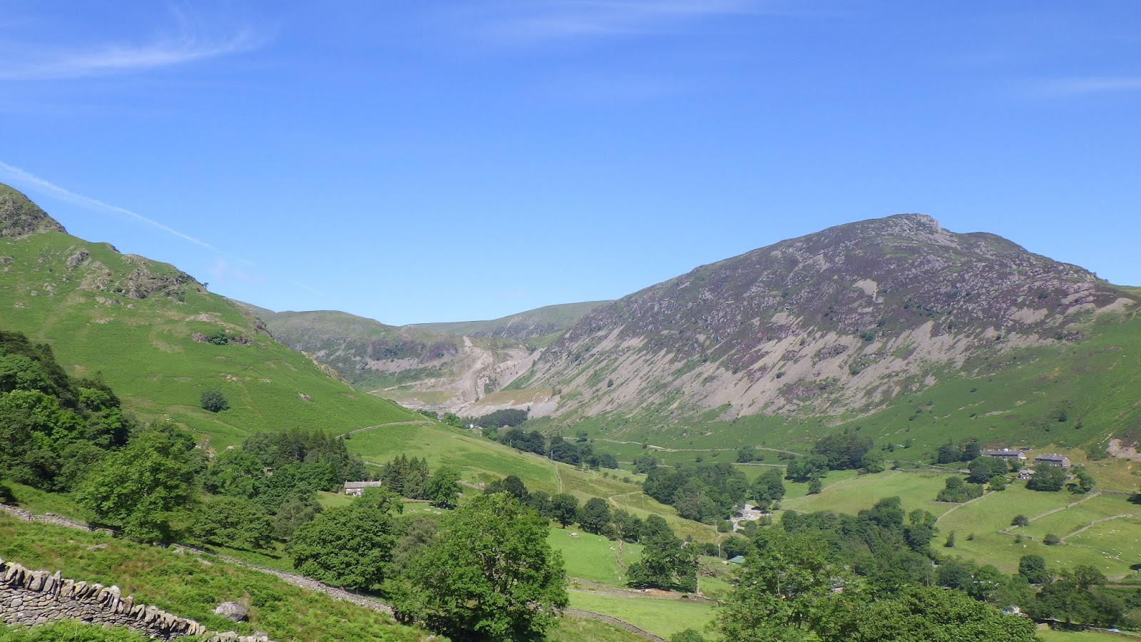
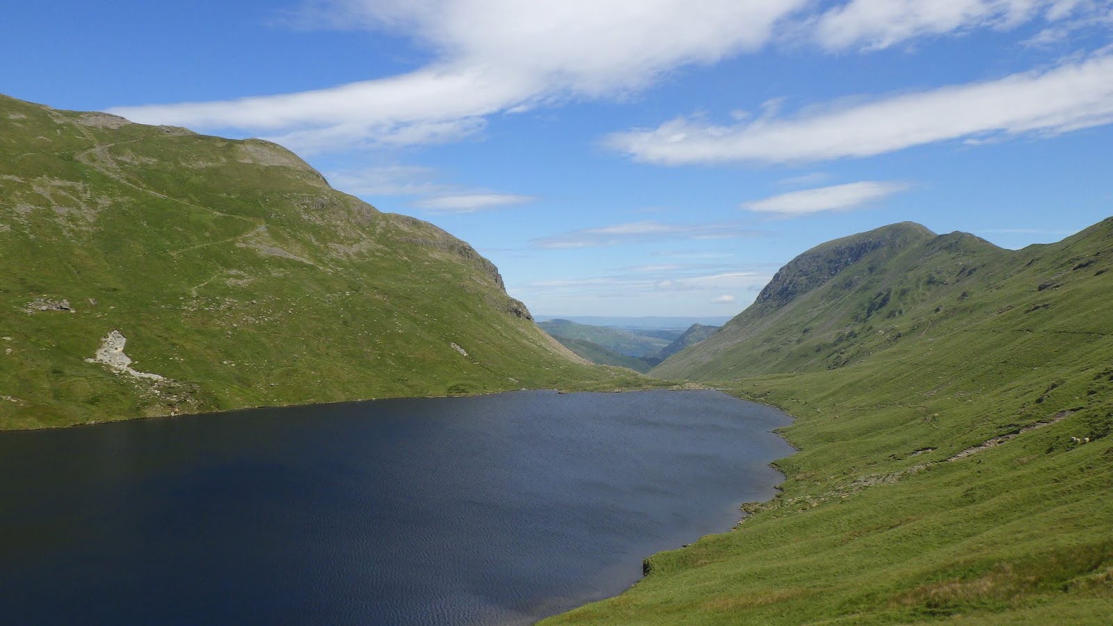
The climb up Glenridding was as brutal as ever, but at least this year it was not chucking it down… Instead the sun was hammering down upon us. When I reached the tarn at the top I couldn’t help but marvel at the deep sapphire blue of the water in the light. At this point the 55 & 110 courses split and those of us going longer headed round to the west to descend over an ancient river bed that was still a stream. You had to properly scramble over the boulders on your way down here, proper 3 points of contact action as you slowly picked your way down to the bottom and the main road. We followed a section of tarmac for a couple of miles, which I found jarring after the extended time on the rocky and grassy trails, till I eventually wound-up in a lay-by and the next aid station.

The heat was intense, so finding the aid station was under the cover of trees was a boon. I noticed the number of people hanging round there was far more than I expected then realised why: they had run out of water. People were not continuing their run without replenishing their supply, which was understandable and were waiting for the aid station to be resupplied. Having plenty of my own I carried-on grateful not to be forced to wait through necessity.

Climbing up from the road I found the heat and humidity stifling. It was hitting the high twenties and it was sapping the life out of me. Fortunately the pathway was part stream, so I took the opportunity to sit in it at one point just to cool myself off!


Eventually the path topped-out on a boggy plateau. Emerging from the trees on to it, the temperature was noticeably lower and a cool breeze wafted over us. Unfortunately progress wasn’t as quick as I had hoped as you had to bounce from ‘babies head’ to ‘babies head’, small mounds of grass that were relatively solid. At this point I overtook a fella who was racing using cheat sticks and didn’t have a Scooby Doo how to use them. What he did was to stand still on top of a babies head, prod the ground with a pole to see if it was solid and take a step forward before repeating. Truly bizarre!

The sun was running away to hide as cloud lowered and the wind was definitely picking-up as we bog-trotted along the plateau. At least we were approaching the next aid station and our drop bags once we dropped off the top…

Coming into the aid station I bumped into Dora on her way out and she gave me a conciliatory hug as she seemed very chirpy to be on her way… I found out why when I got inside the aid station: PIZZA! I had a couple of slices and a warm cup of tea and biscuits as I changed my trainers - I was not sure they were going to last the rest of the race, so took the opportunity to switch them over.

Back down Glenridding.
Traipsing out of the aid station and around the corner we took the path towards the final large climb of the day: Stake Pass. We could see it looming from miles off at the head of the valley we were walking up, its summit shrouded in the grey of clag, the wind steadily picking-up as we neared.

Looking up towards Helvellyn
Climbing the switch-backs to the summit the weather deteriorated with the strengthening wind feeling like a gale and the rain now properly coming-in blown on it. I tried to tough-out the conditions figuring-out I’d be fine once over the top and on the descent, but the temperature was now down in to single figure from the mid twenties of an hour or so ago, the wind sucking all the heat out of your body like a Dementor. I sheltered behind a rock and put my waterproof on to try and beat the elements, my hands going numb as I did so. I stomped to the summit as best I could, hitting the top in the very reduced visibility of clag as the rain drove down hard.


On the top the terrain was wet slippery rock, which is anathema for trail shoes and grip. Passing a marshal he shouted it was only 3 miles to the aid station and I tried to make progress off the summit and hopefully to get below the clag as quickly as possible. Trying to pick a path over the solid rocky surface I saw a gully worn as a path and made for that, skipping towards it before nearly stomping fully into the midriff of a freshly dead sheep carcass!.. Narrowly avoiding a messy accident I tried to descend as fast as I could but was slowed to a walk by the slippery rock, all the while being buffeted by the wind and my hands now freezing - I was faced with the choice of stopping in this highly exposed area to find gloves in my pack to put them on, or to try to tough it out and just put my hands up my sleeves and get down under the clag into warmer air asap.

Sapphire water.
All I could do was grumble to myself, mentally force myself onwards… The marshal was way off on his assessment - the aid station was another 7 miles away from the summit, 7 sodden miles of driving wind and rain. My fingers were like blocks of ice and white through poor circulation from the exertions of what I was doing. No matter what I did I could not get warm. I ate. I drank. I clenched my hands into fists inside the sleeves of my waterproof… At least having the waterproof on I was not losing heat to the wind, but I just did not seem able to shake the chill. Running over the slippery rocks was not an option and finally when it bottomed out I forced myself to jog along the ankle deep stream of a path to try and get some heat generated. Anything. Just anything to get through this. It just didn’t work.

Careful now!
Eventually I found myself on the valley floor near Chapel Stile, familiar territory at least, but knowing I still had a good 3 miles till the aid station. 3 miles of wallowing in self pity and misery, 3 miles at the lowest ebb I have ever been where I could happily have thrown it in… Just to compound my misery the course had now combined with the 55k again and I had the ‘delight’ of chirpy happy runners on that laughing and giggling their way past me as I just wanted to shout at them to FUCK OFF… Then there was the photographer: great that’s all I needed a fucking photographer to capture my moment of abject misery for posterity… I focused. I internalised. There’s no point in proving to the world that I’m a complete bell-end, so I tried my best to hide it away. I pulled my hood right over me and the cords as tight as I could so all that could be seen in the darkness within were my eyes, eyes staring at the ground avoiding contact with everyone.

Descending from the tarn.
The closer I got to the aid station the more the weather improved, the rain even lifted and the wind abated in the shelter of the valley floor. There was a problem though, I was shaking uncontrollably with the cold I was feeling right to my core, even though I could feel on my face there was now some muggy warmth after the downpour. I noticed I was visibly trembling to anyone who could see me, properly shivering and shaking, teeth rattling. I realised I was borderline hypothermic and probably in danger of being hooked from the race if there are proper medics visually assessing us as we arrived. I had to hold myself together as best I could, put all my steel and determination into getting this under control and not revealing how bad a shape I was in to anyone… The other side of the aid station was only a 10k blast up and over Loughrigg Fell to the finish. I couldn’t get hooked from the race within the time limit so close to the end: at worst case it was only a two hour slow plod. To now be so close, failure was not an option.

Stepping stone in the last of the sun.
Entering the aid station I did the most British of things and grabbed a steaming hot cup of tea holding it tight in my hands… And another tub of the noodles, a pot of lifesaving warm tasty noodles. The warming combination inside my belly worked wonders. A salve to the soul. Slowly I could feel the chill subside and was able to stop having to fight the shaking and shivering, slowly I could relax. I reckon I rested there in the warmth of the school at Langdale sitting on a chair made for a 7 year old for about 15 minutes before heading back out… The sun was shining now, the weather and my mood were no longer black.

Bog trotting in the murk
I still wasn’t totally out of the woods mentally or physically. I may have been on the way out of the dark place but I couldn’t afford to slip back. Distraction was the order of the day, so I put on my headphones and disappeared into podcasts: an episode of Ear Hustle about life inside San Quentin State Penitentiary was followed by Richard Herring’s Leicester Square Theatre Podcast as he interviewed Jessica Napit. Taking my mind off introspection with the grim reality of life behind bars and onto a good giggle thanks to Richard Herring.

Approaching Stake Pass in the clag.
By the time this ended I was on top of Loughrigg as the sun began to set… I was going to make it back probably a bit earlier in the day than I had the 55k last year. Soon I was on the descent off the fell towards Rothay Park, the gradient forcing me into a proper jog to the finish and the warm claps and cheers of those still ranged around the line cheering us latecomers home.

That photo!
I’d made it. I’d finished. I’d managed to run the furthest distance I’ve ever managed: 110k, 66 miles or thereabouts. Wow. The enormity of this immediately sank in as I had had to battle the hardest I ever had before to finish and in my fragile emotional state I was nearly reduced to tears, overwhelmed with what I had achieved, more so than when I’ve ever pushed through a barrier before.

Trying not to collapse into a jellied emotional wreck, I went and grabbed some food from the finishers food cart and bumped into Dora who was sitting on a camping chair looking very pained… She had trashed her feet on the way to where we had last crossed paths and had been slowed to a shuffle but ground out a finish just one place above and 10 minutes in front of me. I reckon I must have made nearly half an hour on her over the last 15 miles even in my sorry state so she must really have been suffering and in severe pain, which put my travails into perspective.

I was supposed to go for a beer with Pini after the race, but I was facing a rush to make last orders and I really couldn’t face it. All I could muster was to shower, put on all my warm clothes and climb into the van for a kip.

The next morning dawned and soon enough I was up and cooking mahoosive brekkie baguettes of sausage, bacon egg & black pudding for Pini & me… It turns out he had finished in 14th place in the 55k, the first time he had ever entered a race like this and the first time for him running in the lakes. Oh and Fiona had finished 3rd lady in the 110. A pair of awesome running performances!

Pini perusing paperwork for positions.
It had been an amazing day out in the lakes, 66 long miles through darkness and light (mentally as well as in reality) and in all weather conditions, placing 167/203 finishers whilst squeaking home in under 22 hours by 2 minutes! Yes I know it wasn’t fast, to put it in perspective I took just under double the amount of time of the winner, but I made it and that was the goal. My nearest comparison for a course was the Lakeland 50, which to be honest I found easier than this as the climbs were fewer even if they were largely bigger. I learned a helluva lot today about looking after myself and also how far I can dig down without quitting which will hopefully put me in good stead for the future. With the changeable weather and the effect it had on me it also really brought-home why you have the compulsory kit you carry: it really is there to make a difference in case of emergencies. Emotionally the day certainly proved to be as undulating as the course. They say you experience highs and lows whilst out on tough long runs. Today I experienced this to the nth degree and now know and truly appreciate what they mean when they say it.

Anyway, chapeau to Pini & Fiona on their immense performances in the 55 & 110 and not forgetting Dora who managed to really show how tough she was in getting to the finish on feet that could not walk another step.

Will I be back?.. Too effing right!

Eat pies.
Drink beer.
Run far.